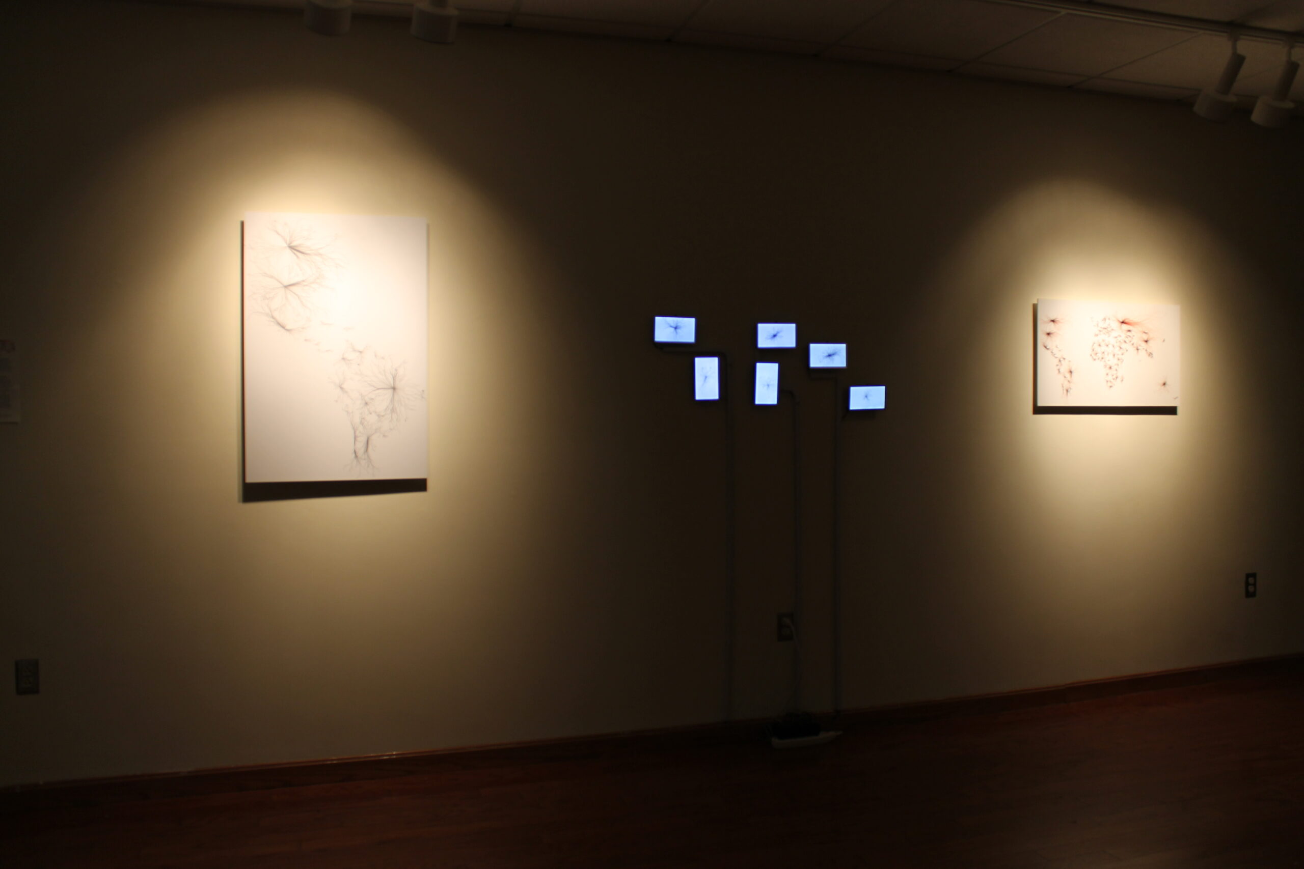
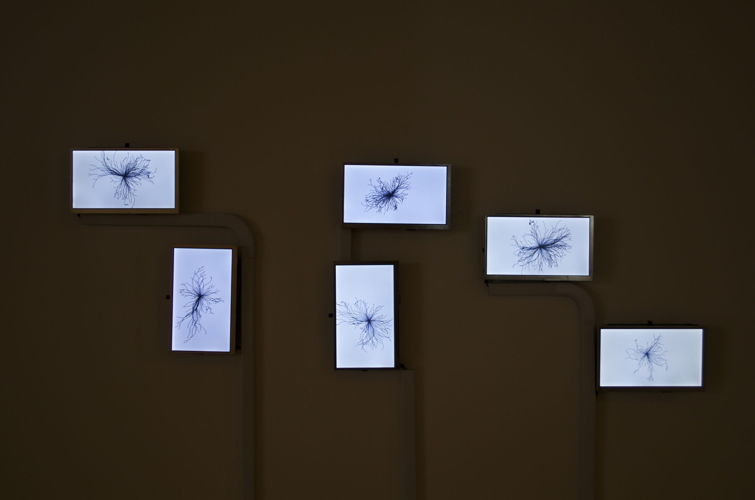
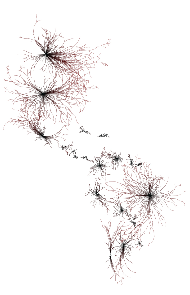
Fractal Maps
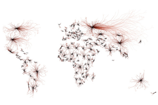
The term fractal was created by the mathematician Benoit Mandelbrot in 1975. He defined fractals as “a rough or fragmented geometric shape that can be split into parts, each of which is a reduced-size copy of the whole”. Fractals have a small structure at a small scale; they capture the richness of various forms. A part of the fractal often looks like the whole. As you look closer, for example, in the border of any map, each succeeding image enlarges a portion of the
previous image.
Many mathematical formulas have helped us understand the complexity of these shapes in a more straightforward, more understandable way. This works’ challenge is to bring these mathematical functions, which are random, to grow semi-controlled. They are drawn with code using Java and Processing based on geographic coordinates. I’m building molded structures geo data. In many pieces, the capital location is the point of origin, and the borders of each state mark the growth path for the fractal.
I create these fractals based on maps because they represent geographical and political borders. They signify the distribution of power and the influence of history.
I want to show the similarities between mathematical and fractal growth and human nature and how we establish borders.